

There have long been plans and visions for Fitchburg Road. Now, the state is investing in a sewer extension and change could really be ahead.
On Nov. 7th, the Town of Ayer announced a $500,000 grant from the state’s Community One Stop Grant program. This will allow sewer to be extended further down Fitchburg Road, toward where a non-profit developer is planning a two-phase 106-unit affordable housing development. The development will include affordable housing units and workforce housing units.
Phase 1 is anticipated to begin in 2027, according to the town’s announcement.
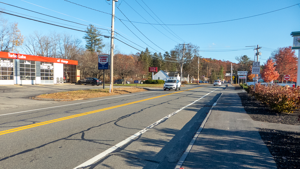
Part of Route 2A, Fitchburg Road has a unique identity, starting at Park Street and continuing past Shop ‘n Save to the Nashua River bridge and the Shirley town line. Most residents are familiar with the road (more than us), but if you’re not, take a drive. From Park Street, you will find a motel and old trailers across the street from Tiny’s Restaurant and a few small homes. Then there is a mix of business and industry, with a Family Dollar store, Turbo Lube, a funeral home and Lorden Oil. If you keep driving, you will see a sign that says, “Welcome to Moore Field.” This leads to the former Fort Devens and a former airport. The State Police and a motorcross operation now use this area.
It’s been a longstanding idea to build housing along this road. In 2023, the Ayer Zoning Board of Appeals approved a Chapter 40B comprehensive permit to rezone 65 Fitchburg Road for residential use.
Long in Transition
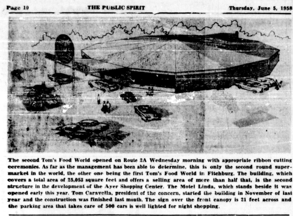
Fitchburg Road was laid out as a state road in 1913, according to the Ayer Layout No. 6133 document, near government property that became Fort Devens. The Motel Linda and Tom’s Food World opened in 1958, according to The Public Spirit. Construction of Tom’s Food World – now Shop n’ Save – that Spring was notable because the building featured a distinct round shape. This was modeled after the other Tom’s Food World store in Fitchburg.
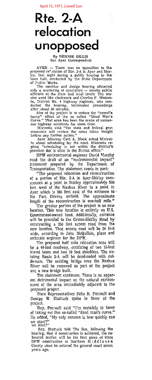
By the 1970s, Fitchburg Road was considered a dangerous road, with nine deaths resulting from car accidents in recent years, The Lowell Sun reported (Jan. 20, 1971).
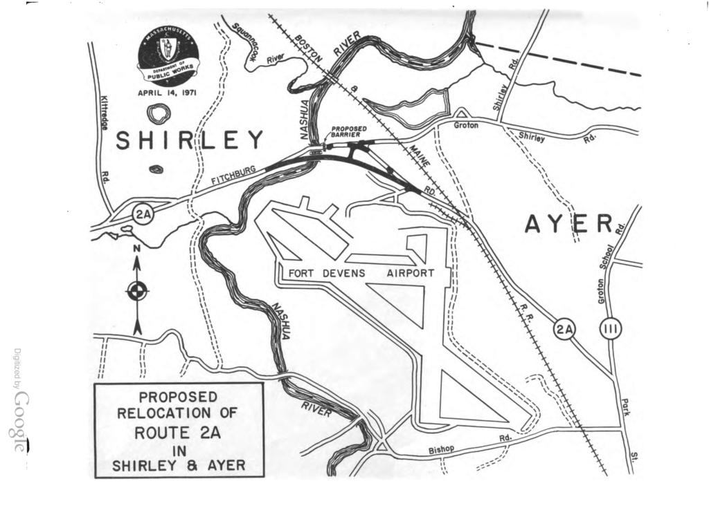
At a public hearing in April 1971, no one voiced any opposition to the state’s proposal to relocate the road. This public hearing was held at Ayer Town Hall and back then, the hearing was covered by a reporter, the “Sun Ayer Correspondent.”
The state Department of Public Works proposed the half-mile relocation entirely on government land. A 250-foot entrance was to be built to Groton Shirley Road, near the Nashua River bridge and Shirley line.
One of the state representatives said, “I’m certainly in favor of taking out this so-called “dead man’s curve” and added, “My only concern is how quickly can we start?” (The Lowell Sun, April 15, 1971).
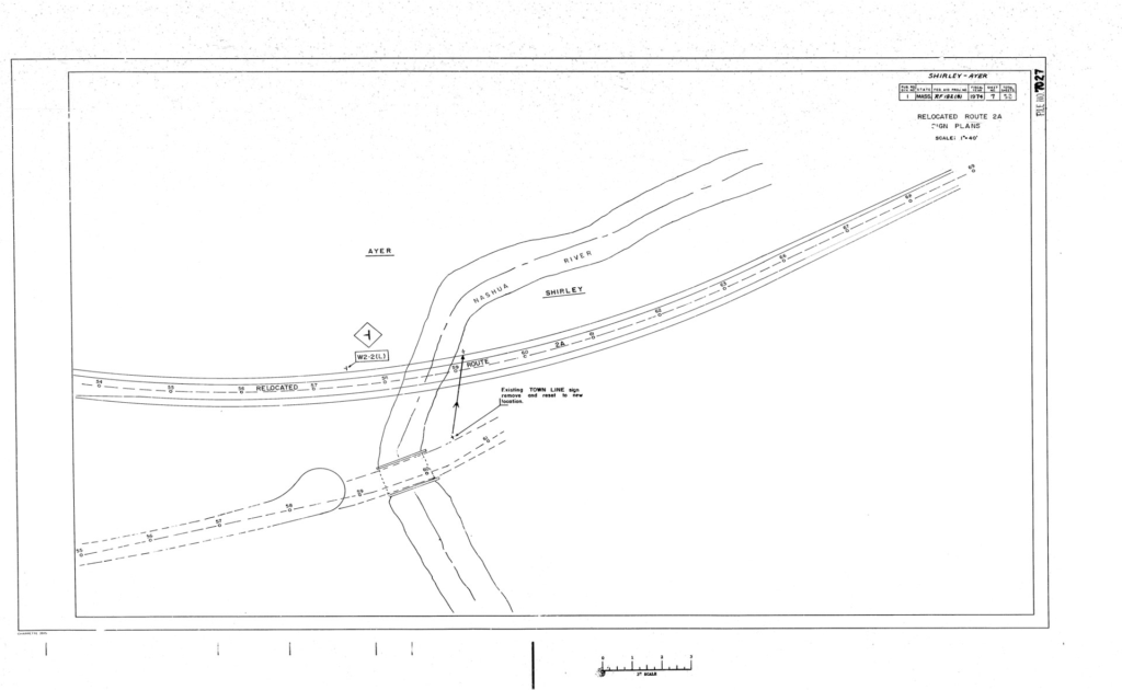
The state filed its relocation plan in 1974, noting the project’s potential impact on one business: the Rotor Club. This building was removed and relocated off the new Route 2A. The 250-foot road would allow customers to drive in. This is thought to be the Cambodian temple at 111 Fitchburg Road (though the state planning document doesn’t note the exact location). Nearby is where the old Route 2A was closed off.
In September 1975, a DPW director shared the state’s plans to set up picnic tables near the Nashua River.
“The state is looking forward to the time when the Nashua River will be cleaned up and fishermen and other canoe and boat owners will enjoy the waters.”
We will continue exploring the history of Fitchburg Road in future articles.